Sacred City Planning -- How Hindu Scriptures Designed Cities Before the World Had Zoning Laws
पवित्र नगर नियोजन -- जब दुनिया में ज़ोनिंग कानून नहीं थे, हिन्दू शास्त्रों ने नगर कैसे बसाए
Introduction -- The Cities That Scripture Built
The next time someone shares an Instagram reel claiming Angkor Wat's layout resembles a microchip, show them this article instead. Because the real story of ancient Indian urban planning is far more impressive than a pattern-matching parlour trick -- and it does not require you to squint at satellite images.
Hindu scriptures contain detailed, systematic descriptions of how to design, build, and govern cities. These are not vague poetic metaphors. Valmiki describes Ayodhya's road widths, building heights, defensive moats, and water-sprinkling systems in Bala Kanda, Sarga 5 of the Ramayana with the specificity of an architect's brief. Kautilya's Arthashastra (Book 2, Chapters 1-4) reads like a municipal planning manual -- complete with zoning regulations, road dimensions in exact Dandas, reservoir construction protocols, and waste management zones. The Manasara Shilpa Shastra (Chapters 9-10) classifies eight distinct city layouts by name, each with a defined geometric grid, street pattern, and water system.
What makes these descriptions extraordinary is not that they exist in isolation. They form an interconnected tradition spanning the Vedas, Epics, Puranas, Shastras, and technical treatises -- a living curriculum of urban science that was taught, practised, and refined for millennia. The UPSC General Studies paper asks about 'town planning in ancient India' almost every cycle. IIT architecture departments study the Manasara's eight layouts as foundational typologies. And the Smart Cities Mission launched by the Government of India in 2015 is, whether its planners know it or not, walking in the footsteps of Kautilya.
This article maps the scriptural evidence systematically -- text by text, chapter by chapter, shloka by shloka.
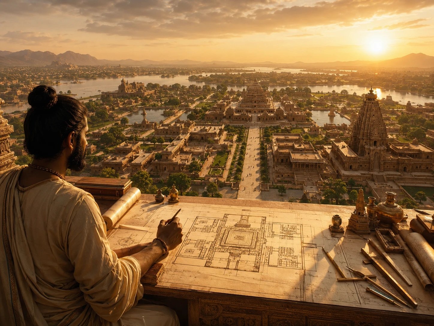
Ayodhya -- The Model City of the Ramayana
The fifth Sarga of Bala Kanda in Valmiki's Ramayana is essentially an urban planning document disguised as poetry. Valmiki devotes an entire chapter to describing Ayodhya before the plot even begins -- a deliberate authorial choice that tells us the city itself is a character in the epic.
The key details, with shloka references from Bala Kanda, Sarga 5:
Shloka 1.5.6: 'Ayodhya nama nagari tatra asit loka vishrutaa, Manunaa maanava indreNa yaa purii nirmitaa svayam.' The city named Ayodhya, world-renowned, was personally built by Manu, the foremost ruler of mankind. Note the word 'nirmitaa' -- constructed, built. This is not a settlement that grew organically. It was designed and built by a sovereign as a deliberate act of statecraft.
Shloka 1.5.7: The city measured twelve Yojanas in length and three Yojanas in breadth (approximately 144 km by 36 km, using the standard Yojana of 12 km). The text uses the word 'su-vibhaktaa mahaa-pathaa' -- well-divided, with great highways. This is explicit grid planning.
Shlokas 1.5.8-9: The royal highways (Rajamarga) were always sprinkled with water and strewn with flowers. Water-sprinkling on roads was not decorative. It was dust suppression technology -- the same principle behind modern road-watering trucks used by municipal corporations across India today. Valmiki is describing a public sanitation system.
Shloka 1.5.10: The city was enclosed by strong fortifications ('saala mekhalaam') and a deep moat ('durgga gambhiira parikha'). The moat served dual purpose: military defence and water management. This is identical to the Arthashastra's later prescription.
Shloka 1.5.11: The city contained 'sataghnis' -- literally 'hundred-killers,' a category of defensive weaponry mounted on bastions. The Yajur Aranyaka provides further technical descriptions of these mounted weapons.
Shlokas 1.5.12-16: Ayodhya had gardens, mango groves, theatrical troupes, multi-storey buildings with balconies and gem-studded facades, markets with shops on both sides of streets, artisans of every craft, and residents where 'no one was without means of subsistence' ('na kashchid anaadhyayanah'). Valmiki is describing a city with public green spaces (udyaana), commercial zoning (stores on both sides), entertainment infrastructure (dancers and theatrical groups), residential high-rises (multi-storey), and a welfare baseline (no destitution).
A software engineer in Bangalore stuck in traffic on the Outer Ring Road might read this and think Valmiki was dreaming. But consider: every single feature Valmiki describes for Ayodhya -- dedicated road maintenance, public green spaces, zoned markets, entertainment districts, multi-level housing, perimeter defence, and a water distribution system -- appears independently in the Arthashastra's prescriptions written centuries later. Either Valmiki was an exceptionally imaginative urban planner, or he was describing a planning tradition that actually existed.
अयोध्या नाम नगरी तत्रासील्लोकविश्रुता। मनुना मानवेन्द्रेण या पुरी निर्मिता स्वयम्॥
ayodhyaa naama nagarii tatra aasiit loka vishrutaa manunaa maanava indreNa yaa purii nirmitaa svayam
There was a world-renowned city named Ayodhya, which was personally built by Manu, the foremost ruler of mankind.
— Valmiki Ramayana, Bala Kanda, Sarga 5, Shloka 6
Lanka -- The Enemy's City Was Also Brilliantly Planned
One of the most intellectually honest aspects of the Ramayana is that Valmiki does not demonise Lanka's infrastructure simply because Ravana rules it. When Hanuman enters Lanka in Sundara Kanda (Sargas 2-4), what he sees is a masterwork of urban design -- and Valmiki describes it with admiration, not contempt.
Sundara Kanda, Sarga 2: Hanuman approaches Lanka and sees a city 'decorated by moats filled with lotuses and water-lilies' ('padma saugandhika yuktaam'), surrounded by 'a golden boundary wall' ('shaatakumbhena praakaareNa'), with 'white and elevated main streets' ('shubhra uchcha rajapathaa') and 'golden-hued archways adorned with sculpted vines' ('hema torana maala'). The text explicitly states that Lanka was 'constructed by Vishwakarma' -- the divine architect of the Devas.
Sundara Kanda, Sarga 3, Shlokas 3-7: Lanka's buildings 'equalled autumnal clouds' in height and grandeur ('sharada ambu dhara prakhyaiH bhavanaiH'). The city was 'served by ocean breeze' -- suggesting deliberate orientation for ventilation. It had 'well-fed and mighty armies' positioned at archways, 'white gates and archways,' and was compared to both Bhogavati (the serpent city) and Amaravati (Indra's capital).
Sundara Kanda, Sarga 4: Hanuman walks Lanka's streets and observes houses 'in various shapes and forms,' hears music from 'the three svaras -- Mandra, Madhya, and Tara,' and notes the tinkling of ornaments, footfall on stairs, and the residential architecture of multiple named Rakshasa chieftains, each with a distinct palace. This is residential zoning by hierarchy.
The theological point is significant. Lanka's physical excellence makes Ravana's moral corruption more damning, not less. He had every material advantage -- a Vishwakarma-designed city, ocean breezes, lotus moats, golden walls -- and still chose adharma. The city is the stage on which the villain's failure becomes inexcusable.
For an architecture student at SPA Delhi or CEPT Ahmedabad, the Sundara Kanda descriptions of Lanka are a case study in how ancient Indian texts understood the relationship between urban form and civilisational identity.
शारदाम्बुधरप्रख्यैर्भवनैरुपशोभिताम्। सागरोपमनिर्घोषां सागरानिलसेविताम्॥
shaarada ambhudhara prakhyaiH bhavanaiH upashobhitaam saagara upama nirghoShaam saagara anila sevitaam
The city of Lanka shone with buildings that equalled autumnal clouds in grandeur, resounding like an ocean, and served by ocean breezes.
— Valmiki Ramayana, Sundara Kanda, Sarga 3, Shloka 3
Indraprastha and Dwarka -- The Mahabharata's Designed Cities
The Mahabharata contributes two major cities to this tradition, both described as products of deliberate architectural design rather than natural growth.
Indraprastha -- the Pandava capital -- was built from scratch on a barren tract of land called Khandavaprastha. The text (Sabha Parva, Chapters 1-3) describes how the Asura architect Mayasura, spared by Arjuna during the burning of the Khandava forest, constructed the famous Maya Sabha (assembly hall) as an act of gratitude. This was not just a building. The Maya Sabha was so architecturally sophisticated that its polished crystal floors resembled water and its actual water pools resembled solid floors -- causing the visiting Duryodhana to lift his garments at a dry floor and fall into a real pool. This is architectural illusion engineering. The political humiliation from this incident becomes one of the proximate causes of the Kurukshetra war.
Dwarka -- Krishna's capital -- receives detailed descriptions in the Harivamsha (an appendix to the Mahabharata) and the Bhagavata Purana (Skanda 10). The texts describe a city built on reclaimed land from the sea, with palaces, gardens, fresh water systems, and residential quarters for thousands. The Archaeological Survey of India (ASI) and the National Institute of Oceanography (NIO) have explored submerged structures off the coast of Dwarka in Gujarat since the 1960s, finding stone structures, anchors, and pottery consistent with a major port city.
The theological significance of both cities is that they are temporary. Indraprastha is lost in the gambling match. Dwarka is submerged by the sea after Krishna's departure. The scriptures use cities as moral allegories: the finest urban planning in the world cannot survive the collapse of dharma among its rulers.
For a startup founder in Koramangala watching a unicorn valuation evaporate overnight, the Dwarka story is uncomfortably familiar. You can build the most beautiful product. If the team's ethics collapse, the ocean takes it back.
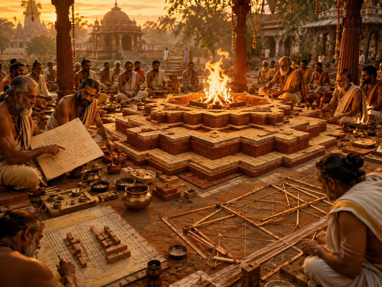
Kautilya's Arthashastra -- The World's First Municipal Planning Manual
If the Ramayana describes what a great city looks like, the Arthashastra tells you exactly how to build one. Kautilya's text, composed circa 4th century BCE (Book 2, Chapters 1-4), is the most detailed pre-modern urban planning document anywhere in the world.
Book 2, Chapter 1 -- Formation of Villages (Janapada Nivesa): Villages of 100-500 agricultural families, spaced one to two Krosas apart (approximately 2-4 km), with defined boundaries and mutual defence capability. This is settlement hierarchy -- the same concept modern urban planners call 'central place theory,' formally articulated by Walter Christaller in 1933. Kautilya had it 2,300 years earlier.
Book 2, Chapter 1, Sutra 20-21: 'Storage reservoirs were to be built using natural springs or water brought from elsewhere.' The king was to 'help people volunteering to build reservoirs by giving them land, building roads, or giving them grants of timber and other implements.' This is public-private partnership in water infrastructure -- a concept India's Smart Cities Mission is still struggling to implement.
Book 2, Chapter 3 -- Construction of Forts (Durga Vidhana): Forts are classified into six types by situation -- mountain fort (Parvata-durga), water fort (Audaka-durga), desert fort (Dhanu-durga), forest fort (Vana-durga), clay fort (Mahi-durga), and human fort (Nri-durga, meaning one whose defence is its people). Each has specific construction requirements.
Book 2, Chapter 4 -- Buildings within the Fort (Durga-nivesa): This chapter reads like a modern zoning code. 'Demarcation of the ground inside the fort shall be made first by opening three royal roads from west to east and three from south to north.' Road widths are specified: chariot roads, royal roads, and roads to pasture grounds shall each be four Dandas (24 feet, approximately 7.3 metres) in width. Roads leading to military stations, burial grounds, and villages shall be eight Dandas (approximately 14.6 metres). The fort shall have 'twelve gates, provided with both a land and water way and a secret passage.'
The chapter then specifies locations for: the treasury, granary, armoury, jail, commercial houses, residential areas for priests and ministers in the inner circle, and artisan and merchant quarters in the outer zones. Waste disposal zones ('smashaana' -- cremation grounds) and burial areas are pushed to the periphery. This is not metaphor. This is a building code.
A CPWD engineer or an IAS officer posted in a new Smart City would find the Arthashastra's specifications startlingly familiar. Road widths of 7-15 metres, concentric zoning, water infrastructure, waste management zones, and security checkpoints -- these are not ancient curiosities. They are the foundation of Indian urban planning.
Manasara Shilpa Shastra -- Eight City Blueprints with Names
The Manasara Shilpa Shastra (Chapters 9-10, approximately 5th century CE or earlier, 10,000 shlokas in 70 chapters) is the most technical of all Indian urban planning texts. Written by the sage Manasara, it dedicates two full chapters to town planning: Chapter 9 (Grama-lakshana, 'Village Characteristics') and Chapter 10 (Nagara-vidhana, 'City Layout').
The text classifies settlements into eight named layouts, each with a distinct geometric logic:
1. Dandaka ('Staff-shaped') -- Rectangular grid with straight streets crossing at right angles. Two main entrance gates. Used for small towns and villages. Streets one to five Dandas wide. Village offices in the east.
2. Sarvatobhadra ('Auspicious in all directions') -- Applied to larger towns. Square site fully occupied by houses of all classes. This is the most egalitarian layout -- all residents share the same grid.
3. Nandyavarta ('Named after a flower') -- For towns of 3,000-4,000 houses. Circular or square sites. Streets parallel to central arteries. Temple of the presiding deity at the centre.
4. Padmaka ('Lotus-shaped') -- Streets radiate outward from a central temple like lotus petals. Equal length and breadth. Enclosed by circular, quadrangular, hexagonal, or octagonal walls. The city is an island surrounded by water -- no scope for expansion. This is the most visually striking layout.
5. Swastika ('Auspicious') -- Diagonal streets dividing the site into rectangular plots. Two main streets cross at the centre (south-north, west-east). Surrounded by a rampart wall with a moat at its foot filled with water. Eight gates. Temple at the centre, Buddhist temple in the Vayu cell, Jain temple in the south-west.
6. Prastara ('Couch-shaped') -- Square or rectangular site divided into 4, 9, or 16 wards by a network of streets. Width varies from 6-11 Dandas. Notably, the main roads are wider than in other patterns. Sites allocated by economic class: poor, middle, rich, and very rich.
7. Karmuka ('Bow-shaped') -- Semi-circular or semi-elliptical. Used for coastal towns (Pattana, Kheta, Kharvata). One principal street runs west-east, two car streets in a curved pattern. This is the only layout specifically designed for seafront geography.
8. Chaturmukha ('Four-faced') -- Square or rectangular with two main streets in cardinal directions. The most symmetrical of all layouts.
Every layout prescribes: a temple at or near the centre, defined road hierarchy, a water system (moats, tanks, or wells), and distinct residential, commercial, and sacred zones. The Manasara also prescribes four categories of buildings: Janabhavana (houses for common people), Rajabhavana (palaces for rulers), Devabhavana (religious shrines), and public buildings (rest houses, gardens, libraries, reservoirs, wells).
The city of Jaipur, designed by Maharaja Sawai Jai Singh II in 1727 with the help of architect Vidyadhar Bhattacharya, is built on the Prastara layout from the Manasara -- a grid of nine blocks (navagraha pattern) with the palace at the centre. When UNESCO inscribed Jaipur as a World Heritage Site in 2019, they were recognizing a living application of a text written over a millennium earlier.
The Eight City Layouts of the Manasara Shilpa Shastra
| Layout Name | Sanskrit | Shape | Street Pattern | Water System | Best Used For |
|---|---|---|---|---|---|
| Dandaka | दण्डक | Rectangular | Straight grid, right angles | Wells | Small towns, villages |
| Sarvatobhadra | सर्वतोभद्र | Square | Full grid, all classes mixed | Tanks and wells | Large mixed-use towns |
| Nandyavarta | नन्द्यावर्त | Circular or Square | Parallel to central arteries | Central tank | Towns of 3,000-4,000 houses |
| Padmaka | पद्मक | Equal length-breadth | Radial like lotus petals | Surrounding water (island city) | Fortified island cities |
| Swastika | स्वस्तिक | Any shape | Diagonal with central cross | Moat at foot of rampart wall | Fortified towns with 8 gates |
| Prastara | प्रस्तर | Square or Rectangle | Network dividing 4-16 wards | Multiple sources | Class-stratified towns (Jaipur model) |
| Karmuka | कार्मुक | Semi-circular (bow) | Curved streets following coastline | Sea access + internal wells | Coastal port towns |
| Chaturmukha | चतुर्मुख | Square or Rectangle | Cardinal axis streets | Symmetrical tanks | Symmetrical ceremonial cities |
Source: Manasara Shilpa Shastra, Chapters 9 (Grama-lakshana) and 10 (Nagara-vidhana). The Manasara is one of five surviving complete texts on Hindu Vastu Shastra. Jaipur (1727) follows the Prastara layout; coastal towns like Lothal follow the Karmuka principle.
Water, Waste, and Welfare -- The Complete Municipal System
Across these texts, three municipal systems recur with remarkable consistency:
Water Management: The Arthashastra (2.1.20-21) mandates reservoir construction using natural springs or diverted water. The Ramayana describes Ayodhya's roads being sprinkled with water (Bala Kanda 5.8-9) -- a public works programme. Lanka's moats in the Sundara Kanda are filled with lotuses, suggesting managed aquatic ecosystems, not stagnant ditches. Every Manasara layout includes a water system -- moats, tanks, wells, or full surrounding water bodies. The Matsya Purana (Chapter 270) provides specifications for public pavilions near water tanks. And the stepwell tradition -- Rani ki Vav in Patan (UNESCO World Heritage, 11th century) and Chand Baori in Abhaneri (9th century) -- represents the engineering perfection of this textual tradition.
Waste Management and Sanitation: The Arthashastra places cremation grounds and waste zones at the periphery of the fort (Book 2, Chapter 4). The Manusmriti (4.46, 4.56) prohibits disposal of waste in water bodies and prescribes locations for waste outside settlements. The Ramayana's description of Ayodhya notably emphasises cleanliness: roads sprinkled with water, flowers strewn, and no resident without means of livelihood. Absence of destitution is itself a waste-management and public-health strategy -- impoverished populations without sanitation access create the health crises that well-planned cities prevent.
Governance and Public Welfare: The Arthashastra's foundational principle is 'Prajaa sukhe sukham raajnah, prajaanaam cha hite hitam' -- the happiness of the king lies in the happiness of his people, and the king's benefit lies in the benefit of his people (Book 1, Chapter 19). This is not a decorative slogan. The entire urban planning framework in Books 1-4 is built on this welfare principle. Road construction serves the people. Reservoir construction serves the people. Even the fort's twelve gates are designed for civilian access ('provided with both a land and water way'), not just military control.
The Shukra Niti Sara, another ancient Indian political treatise, classifies towns by function: Rajdhani (capital), Pattana (commercial centre), Kharvata (smaller town), Nigama (market town), and Grama (village) -- a settlement hierarchy that mirrors modern Indian administrative classification from metropolitan cities to gram panchayats.
प्रजासुखे सुखं राज्ञः प्रजानां च हिते हितम्। नात्मप्रियं हितं राज्ञः प्रजानां तु प्रियं हितम्॥
prajaasukhe sukham raajnah prajaanaam cha hite hitam naatmapriyam hitam raajnah prajaanaam tu priyam hitam
The happiness of the king lies in the happiness of his subjects. Their welfare is his welfare. What pleases himself is not the king's good -- what pleases his people is his good.
— Kautilya Arthashastra, Book 1, Chapter 19, Sutra 34
The city of Jaipur, designed in 1727 by Maharaja Sawai Jai Singh II, follows the Prastara layout from the Manasara Shilpa Shastra -- a nine-block grid (Navagraha pattern) with the palace at the centre. When UNESCO inscribed Jaipur as a World Heritage Site in 2019, the citation specifically praised its 'exchange of ideas from ancient Hindu and modern Mughal and Western cultures' -- essentially acknowledging that a 1,500-year-old Sanskrit text shaped a living World Heritage city. The Arthashastra's prescribed road width of four Dandas (approximately 7.3 metres) is remarkably close to the modern Indian standard of 7.5 metres for urban collector roads under IRC (Indian Roads Congress) specifications.
The Arthashastra prescribes six types of forts by geography: Parvata-durga (mountain fort, like Raigad or Chittorgarh), Audaka-durga (water fort, like Janjira), Dhanu-durga (desert fort, like Jaisalmer), Vana-durga (forest fort, like Ranthambore), Mahi-durga (clay/earthen fort), and Nri-durga (human fort -- one whose defence is its people). Every major fort in Indian history fits one of these six categories. When Chhatrapati Shivaji Maharaj built his network of hill forts across the Sahyadris, he was applying the Parvata-durga principle from a text written nearly 2,000 years before his time.
Textual Sources -- A Complete Reference Map
For the reader who wants to go deeper, here is the complete map of primary sources referenced in this article:
Valmiki Ramayana: Bala Kanda, Sarga 5 (Shlokas 6-23) -- Ayodhya's layout, roads, buildings, defences. Sundara Kanda, Sarga 2 (Lanka's first aerial view), Sarga 3 (Lanka's architecture and defences, Shlokas 3-7), Sarga 4 (Lanka's interior streets and residential zones). Yuddha Kanda, Sarga 123 (Rama shows Lanka from the Pushpaka Vimana to Sita -- confirming Vishwakarma's authorship of the city).
Mahabharata: Sabha Parva, Chapters 1-3 (Construction of Indraprastha and the Maya Sabha by Mayasura). Mausala Parva (submersion of Dwarka). Harivamsha Parva (detailed Dwarka descriptions).
Bhagavata Purana: Skanda 10 (Dwarka's palaces, gardens, water systems, and residential quarters for Krishna's queens).
Kautilya Arthashastra: Book 2, Chapter 1 (Janapada Nivesa -- village formation, water reservoirs). Chapter 2 (Bhumi Vibhaga -- division of land, elephant and horse ranges). Chapter 3 (Durga Vidhana -- fort construction, six fort types). Chapter 4 (Durga Nivesa -- buildings within the fort, road widths in Dandas, zoning, twelve gates). Book 1, Chapter 19 (welfare principle: Prajaa sukhe sukham raajnah).
Manasara Shilpa Shastra: Chapter 9 (Grama-lakshana -- eight village layouts with geometric specifications). Chapter 10 (Nagara-vidhana -- eight city layouts, four building categories).
Matsya Purana: Chapter 270 (pavilion specifications near water tanks, pillar classifications).
Manusmriti: Chapters 4.46, 4.56 (prohibitions on waste disposal in water bodies, sanitation rules).
Shukra Niti Sara: Settlement hierarchy (Rajdhani, Pattana, Kharvata, Nigama, Grama).
Brihat Samhita (Varahamihira): Chapters on site selection for towns based on soil testing, water table analysis, and cardinal orientation.
Conclusion -- The Real 'Ancient Technology'
The Instagram post that started this conversation asked: 'Are we looking at temples or ancient hardware?' The answer is neither. We are looking at cities.
Hindu civilisation did not need to secretly embed microchips in temple layouts. It had something far more impressive: a continuous, documented, multi-text tradition of urban planning that specified road widths, water systems, waste zones, residential hierarchies, defensive structures, and public welfare principles -- all grounded in the foundational ethic that the ruler's happiness depends on the people's happiness.
From Manu building Ayodhya in the Ramayana, to Vishwakarma designing Lanka, to Mayasura engineering Indraprastha, to Kautilya writing the world's first municipal planning manual, to the sage Manasara classifying eight city geometries by name -- this is a civilisational achievement that needs no exaggeration, no pseudoscience, and no comparison to circuit boards.
The next time someone tells you ancient Indians were secretly electrical engineers, tell them the truth. They were openly, brilliantly, and documentedly -- urban planners.
Read the Arthashastra and Ramayana
Explore the original scriptures that shaped Indian urban planning. Read Valmiki Ramayana's Bala Kanda and Sundara Kanda for city descriptions, and study the Arthashastra's governance principles.
Tags
Eternal Raga · शाश्वत राग
Institutional voice — scholarly articles on Sanatan Dharma
Deepen Your Understanding
अपनी समझ और गहरी करें
vedic sciences
Vastu Shastra -- The Ancient Science of Architecture That India Still Builds By
Before Frank Lloyd Wright talked about buildings harmonising with nature, before Le Corbusier designed Chandigarh, and before LEED green-building certifications existed, Indian architects were writing Sanskrit manuals on how to align a house with sunlight, wind, water, and the earth's magnetic field. Vastu Shastra -- literally 'the science of dwelling' -- is not superstition wrapped in incense. At its core, it is an empirical framework for orienting buildings so that natural light, ventilation, and thermal comfort work in the occupants' favour. The problem is that centuries of misapplication have buried the science under astrology, pseudoscience, and real-estate marketing. This article separates the architecture from the astrology.
vedic sciences
Sthapatyaveda -- The Science of Building and Sacred Space
The fourth Upaveda treats space the way Gandharvaveda treats sound: as something with a structure, a deity, and a method. From Akshardham Delhi to a Pune flat with a tulsi corner, the same Sthapatyaveda principles are at work.
vedic sciences
Vedic Water Harvesting -- Stepwells, Tanks, and the Engineering Bharat Forgot
Bengaluru is running out of water. Chennai had a Day Zero. Yet a 5th-century Patan stepwell still holds water in summer. Sringaverapura's 2-million-litre Mauryan reservoir is intact. The water systems Bharat built between 1500 BCE and 1500 CE are starting to look like the future, not the past.
sacred symbols
Temple Architecture Symbolism -- Why Every Hindu Temple Is a Human Body, a Mountain, and the Universe
The dark womb-room at the centre. The tower rising above it like a spine. The gateway that frames the divine like an eye. A Hindu temple is not a building where you go to see God. It IS the body of God -- designed on a mandala grid, proportioned by sacred mathematics, and oriented to catch the first ray of the rising sun.
vedic sciences
Kaal Ganana -- The Hindu Measure of Time
From a single blink of the eye (Nimesha) to one Day of Brahma (4.32 billion years) -- explore the complete cosmic time hierarchy of Hindu cosmology, anchored in Vishnu Purana 1.3, with its remarkable parallels to modern science.
scriptural exegesis
Sugriva's Search for Sita -- The Intelligence Network Hidden in the Ramayana
No phones, no satellites, no maps. Yet Sugriva found Sita across an entire continent. He did not send a random army -- he built a four-directional intelligence network with designated leaders, precise geographical routes, and a strict one-month deadline. Kishkindha Kanda, Sargas 40-43, reads less like an ancient epic and more like a military operations manual. The Ramayana was not just telling a story. It was teaching strategy.
The city of Jaipur, designed in 1727 by Maharaja Sawai Jai Singh II, follows the Prastara layout from the Manasara Shilpa Shastra -- a nine-block grid (Navagraha pattern) with the palace at the centre. When UNESCO inscri…
More in Vedic Sciences
Agnichayana -- The Falcon-Shaped Fire Altar That Survived 3,000 Years
12 min read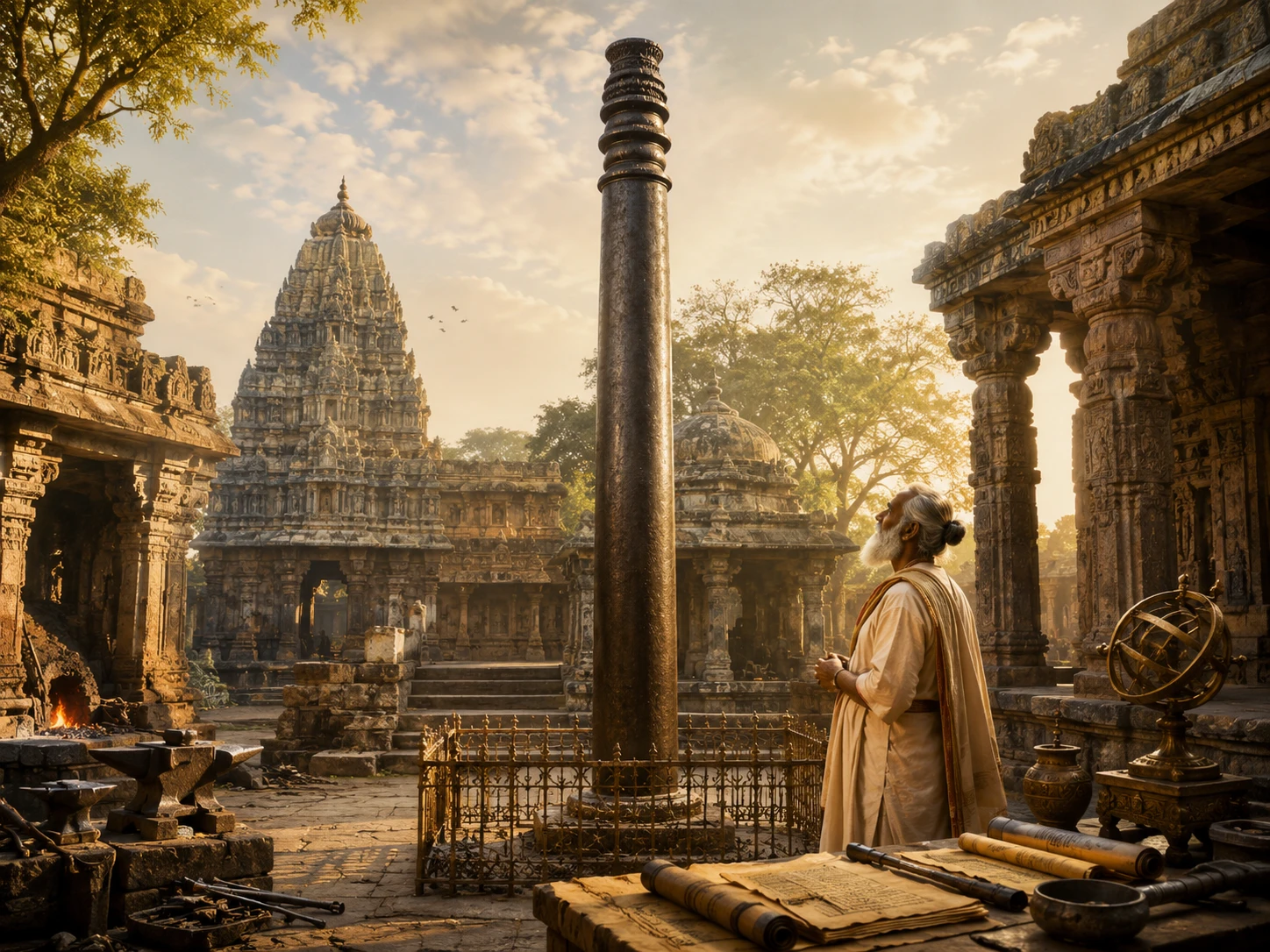
Ancient Indian Metallurgy -- The Iron Pillar That Refuses to Rust
13 min read
Charaka vs Sushruta -- The Two Founders of Ayurveda and Why India Had Both Internal Medicine and Surgery 2,000 Years Ago
12 min readThe same translation error that turned '33 Koti' into '33 crore' in Hinduism also happened in Buddhism. The Chinese translation of Buddhist texts rendered 'Sapta Koti Buddha' (7 Supreme Buddhas) as '7 Crore Buddhas.' The…
Deities AvatarsCommunity Reflections
🕉️
Be the first to share your reflection.